
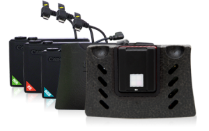
Discover the Horus Dynamics drone sensors and all possible customizations.
NIR Sensors
S110 NIR, like all the cameras intended for SenseFly Mikaela Ag, this 12 MP custom model has been adapted so that it can be controlled by the drone autopilot. It acquires image data in the near infrared band (NIR), the region in which it occurs in the plant high reflectance. Its exposure parameters can be set manually and can produce shot in RAW.
Sensors RE
S110 RE, with its sensor from 12MP, acquires data in the red spectrum band, the region in which it changes reflectance of a plant. The exposure parameters of the S110 RE can also be manually set and can produce RAW drone sensor files.
Cameras for Photogrammetry
SenseFly S.O.D.A.
SenseFly S.O.D.A. is the first camera to be designed for the photogrammetry with professional drone. It captures aerial RGB images incredibly sharp, in a series of light conditions, allowing to produce detailed ortofotografie, vivid orthomosaics and high precision digital surface models.
G9X RGB
G9X RGB with 20 MP is a drone-photogrammetric camera that captures regular image data in the visible spectrum. However, unlike the default supplied with the camera’s airflow, its exposure parameters can be manually set and can produce RAW-format image files even at the output.
Wx
It is a photogrammetric camera, as all cameras destined for Mikaela are suitable for topographic use, this 18.2 MP model has been adapted so that it can be controlled by the drone autopilot. Captures the image data in the visible spectrum and its exposure parameters are automatically set.
Multispectral
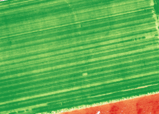
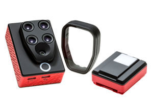
Multispectral cameras allow simultaneous analysis of an extended range of light spectrum data. Parrot Sequoia, for example, is the smallest, lightest multispectral sensor ever released. It captures images in four visible and non-visible spectral bands, in addition to RGB images, in a single flight.
Cameras
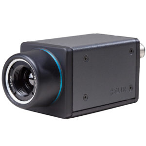
Flir Thermal Imaging Cameras
We have different possibilities of inspection customization with FLIR sensor cameras.
ThermoMAP-Sense Fly
ThermoMAP allows you to capture thermal images and videos, allowing you to create thermal maps of an entire area in 3D (for example, to map water distribution, control irrigation systems or to evaluate the functionality of solar panels).
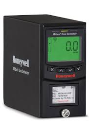
Gas Sensors
We have different possibilities of customization with certified industrial gas sensors, with possibility of interfacing within a network of industrial plants with alarms and thresholds.