
Discover Albris sensefly The professional drone price and info
Professional drone for photogrammetry and advanced cartographic surveys.
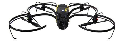
Developed and manufactured in Switzerland, the Multirotor drone Albris SenseFly is designed and produced specifically for professional aerophotogrammetric relief. Thanks to the 22 minutes of autonomy and the completely automatic Waypont system of extreme simplicity, it revolutionizes the concept of photographic survey thanks to an unprecedented precision and to the ability of cover also large surfaces in a single flight.
Click here to see the price of the drone
Capture high-resolution aerial images that can be transformed into orthomosaic and 3D models of extreme precision.
It also has the possibility of taking vertical photographs, furthermore the professional drone Albris has the possibility to land independently, but above all the ability to realize geo-referenced shots in both RGB and infrared For greater precision. With its RGB and Thermal Chamber it is able to take photographs with a resolution until 1cm/pixel.
The images acquired by the Albris professional drone have GPS and IMU data and so they are ready for subsequent photogrammetric processing steps with the Pix4D software included in the price, for the extraction of DSM, DTM, Level curves, Ortomosaici and 3D models.
The Albris SenseFly professional drone for Photogrammetry can create topographic and 3d buildings at 1 Cm/Pixel.
Albris SenseFly, the most accurate photogrammetric drone on the market.
Technical Specifications
- Autonomy: 22 Minutes
- Datalink Radio Coverage: 2 Km
- Vertical Landing
Buy