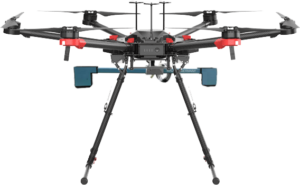
The integrated system combines the drone with a Metal Detector metal detection device.
The use of a Metal Detector on a drone allows you to scan the area to detect metals several times faster than a portable device and allows you to obtain geo-localized heat maps of the area. To plan a survey mission, simply mark the area of interest on the map and start an automatic flight mission. The integrated Metal Detector + drone system detects precious metals and metal objects buried up to a maximum depth of 10-15 meters and generates a GeoTIFF image of magnetic field anomalies.
One of the main components of the integrated system that allows efficient planning of the survey, the flight planning software that provides tools for easy creation and calculation of flight routes and the interpretation of the data acquired intuitively.


